
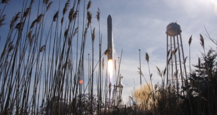
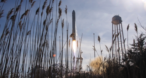
Here’s a list of public viewing sites along the ocean side of Virginia’s Eastern Shore. They are grouped into distance from Wallops Island, near Chincoteague, which is ground zero. NASA determines the precise rocket trajectory for each launch and exact sightlines vary from launch to launch.
UPPER SHORE
1 mile from Wallops Island
Arbuckle Neck in Assawoman
- From RT 13 , turn east onto RT 691 (John Taylor Road)
- Follow to stop sign
- Turn left onto Metompkin Road/Atlantic Road
- Following Atlantic Road, turn right onto Arbuckle Neck Road
4 miles from Wallops Island
The Water’s Edge Restaurant
- From RT 13, turn east at T’s Corner Stop Light onto Chincoteague Rd/VA-175
- Travel on RT 175 for approximately 3.5 miles and turn right at the stop light on VA RT 798
- Continue 1.3 miles and turn left onto Wright Road
- Follow on Wright Road 1.6 miles; restaurant sits on Watts Bay
5 miles from Wallops Island
NASA Visitor’s Center
Building J-17, Wallops Island, VA 23337
- From RT 13, turn east at T’s Corner Stop Light onto Chincoteague Rd/ VA- 175
- Located about 7 miles on RT 175, outside of NASA Wallops Facility on right-hand side
5 miles from Wallops Island
Wisharts Point Landing in Atlantic
- From RT 13 , turn east onto RT 691 (John Taylor Road)
- Follow to stop sign,
- Turn left onto Metompkin Road/Atlantic Road
- Following Atlantic Road, turn right onto RT 695 ( Wisharts Point Road) to the end at the water
6 miles from Wallops Island
Queen’s Sound Landing – Space Limited
On right side of RT 175 along Causeway to Chincoteague Island
- From RT 13, turn east at T’s Corner Stop Light onto Chincoteague Rd/VA- 175
- Follow RT 175 7.9 miles to public boat landing on right
7 miles from Wallops Island
Curtis Merritt Harbor
2246 Curtis Merritt Harbor
- From RT 13, turn east at T’s Corner Stop Light onto Chincoteague Rd/VA -175
- Follow RT l75 across causeway and bridge to Chincoteague Island
- After the bridge ends, turn right onto Main Street, heading south
- Toward the end of the road you will see the harbor entrance on the left side.
7 miles from Wallops Island
Town Dock/Robert Reed Park
4083 Main Street, Chincoteague Island, Va. 2333
- From RT 13, turn east at T’s Corner Stop Light onto Chincoteague Rd/ VA – 175
- Follow RT l75 across causeway and bridge to Chincoteague Island
- After the bridge ends, turn right onto Main Street, heading south
- Entrance is through Don’s Seafood Restaurant parking lot
10 miles from Wallops Island
Gargatha Landing in Gargatha
- From RT 13 , turn east onto RT 680 (Gargatha Landing Road)
- Follow RT 680 to the water
12 miles from Wallops Island
Pierce Taylor Road at Old Ferry Dock
- From RT 13, turn east onto RT 689 (Mappsville Road)
- Go straight at the stop sign crossing over Metompkin Road
- Turn left on RT 730 (Pierce Taylor Road), follow to Old Ferry Dock
MIDDLE SHORE
25 miles from Wallops Island
Wachapreague Town Marina in Wachapreague
Directions
- Turn east off RT 13 onto Wachapreague Road (RT 180) at stoplight.
- Turn onto Atlantic Ave. Harbor on left.
25 miles from Wallops Island
Island House Restaurant
- Turn east off RT 13 onto Wachapreague Road (RT 180) at stoplight.
- Turn onto Atlantic Ave. Harbor on left.
35 miles from Wallops Island
Willis Wharf boat ramp in Willis Wharf
- Turn east off RT l3 onto RT 178 at Exmore Stop Light, road becomes US13 Business, go 0.6 Miles
- Turn left onto RT 603 ,Go 1.8 Miles
- Turn left into Willis Wharf Harbor
LOWER SHORE
44 miles from Wallops Island
Red Bank boat ramp in Red Ban
- Turn east off of US-13 S onto Red Bank Rd, RT 617, go 1.9 miles
- Turn left Red Bank Ct
- Bear right to boat ramp
58 miles from Wallops Island
Oyster Harbor/Boat Ramp
6398 Ocean View Lane
- Turn east from RT 13 N onto Bayside Rd in Cheriton, go 0.2 miles
- Turn left onto RT 638 (Sunnyside Rd), go 2.6 miles
- Turn left onto Crumb Hill Road in Oyster, go 2 miles to Ocean View Lane and boat ramp
68 miles from Wallops Island
Eastern Shore Wildlife Refuge
32205 Seaside Road
- Turn east from US-13 N at first road on right after Chesapeake Bay Bridge Tunnel- RT 600
- Follow RT 600 east until you have to turn, about 0.5 miles
- Turn right onto Seaside Rd into the Wildlife Refuge and follow this road to the boat ramp at the end
Comments are closed.